Katfish Reach
Katfish Reach is 38 km of creeks and wetlands starting just downstream of Berri in the heart of South Australia’s Riverland. It includes some of the best camping and canoeing spots along the Murray. Abundant birdlife is a feature.
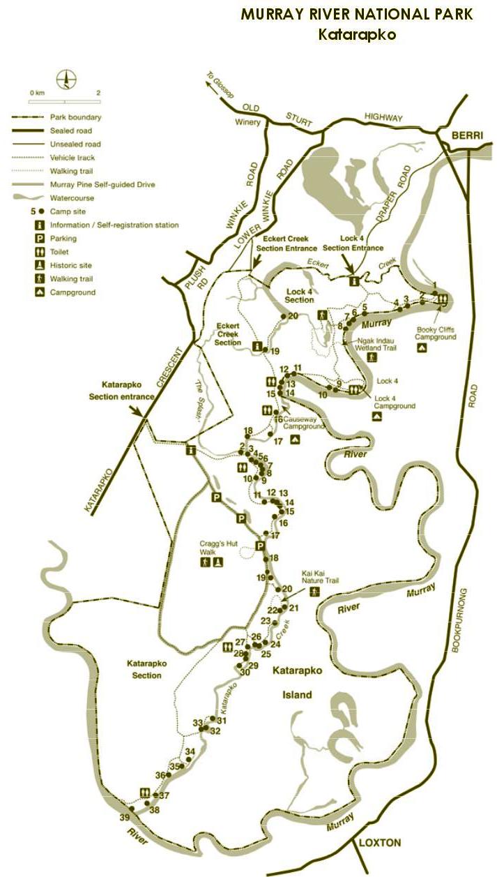
Eckert’s and Katarapko Creeks are two anabranches that meander through the Murray River National Park. It’s all within a 5 – 30 minute drive from Berri – but you could be a world away. There’s 60+ campsites to choose from and kayaking/canoeing routes that range from wide and placid to narrow and adventurous – something to suit everyone.
Katarapko Creek is a popular kayak/canoe camping trip. A weekend trip can take in Gurra Gurra Creek, the majestic Bookpurnong Cliffs, Ajax Achilles Lakes, Lock 4 and a secluded campsite on Katarapko Creek. It’s not too difficult for novices and can be shortened or lengthened to suit (we arrange pick-up for one-way trips. You can ring us along the way to change plans if you decide to go further, or shorten your trip).
Eckerts Creek is great for the more adventurous paddler. It includes a lot of narrow windy sections and some faster flow.
Eckerts Creek eventually flows into Katarapko Creek, giving the opportunity for an extended paddle off the main river.
We also deliver kayaks/canoes to campsites if you’re planning on staying at one site.
Information on current local conditions can be important when planning your camping or paddling, so give us a call on 04 211 676 45, or check out our website under “Hire” or “Canoe Camping/Expeditions”: www.canoeadventure.com.au
Eckerts Creek has benefitted most from the Katfish Reach Environmental Rehabilitation Project (Katfish Reach is an abbreviation of “Katarapko and Eckert Creek Demonstration Reach for Native Fish”). Restricted flows for several decades made a less-than-ideal environment for native fish and difficult navigation for kayaks. The high river of 2011 cleared out the reeds that blocked some sections. A new series of regulators and fishways is breathing new life into the whole system and restoring water flows to a higher, more natural level.
Katfish Reach project aims are:
- Improving floodplain and wetland health
- Managing water to create a more natural cycle of flooding and drying
- Increasing native fish numbers
- Improving native fish movements and flow through the removal of barriers
- Improving the health of native plant communities
- Controlling pest animals and weeds
- Improving habitat for native animals including threatened species
- Recognising the importance of traditional Aboriginal culture and European heritage
You can find out more about it at: www.katfish.org.au
This National Park map covers the whole Katfish Reach area. A Murray River National Park brochure and more detailed maps can be downloaded from: (Note – Dec 2020 – this map is now outdated as campsites have been renumbered)